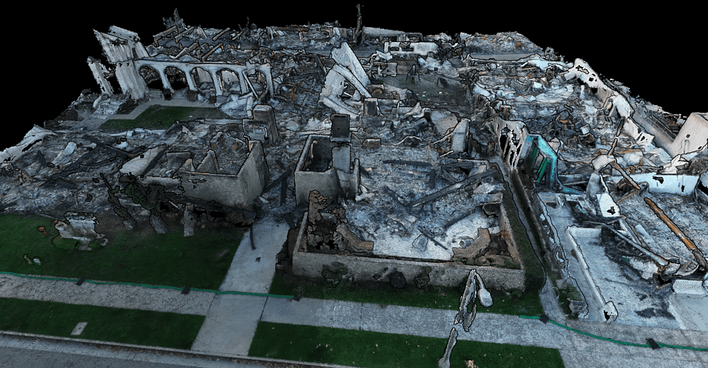
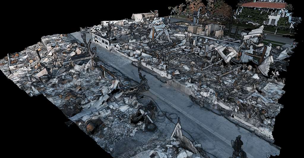
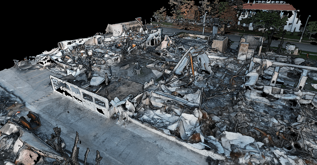
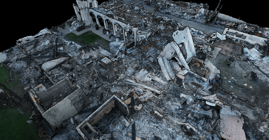
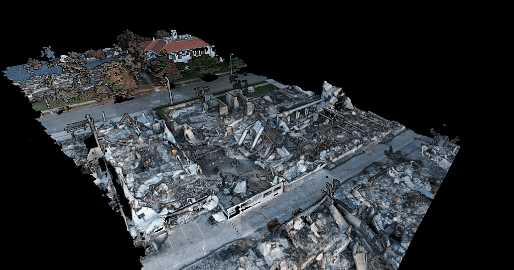
3D visualization for remote site management
At Nasha, we leverage high-resolution drone imagery to create precise digital twins of your construction and real estate projects
Track Progress and Save Time
Centimeter accurate 3D models allow for increased confidence in monitoring construction progress remotely, reducing need for regular on-site visits while amassing a catalog of models over time.
Make Informed decisions
Integrate 3D models to CAD software to further aide in design iterations, catch errors sooner, and provide accurate forecasts.
Increase Collaboration
Easily and securely share models amongst team members, contractors, and stakeholders.


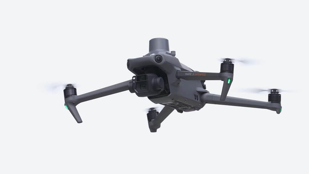
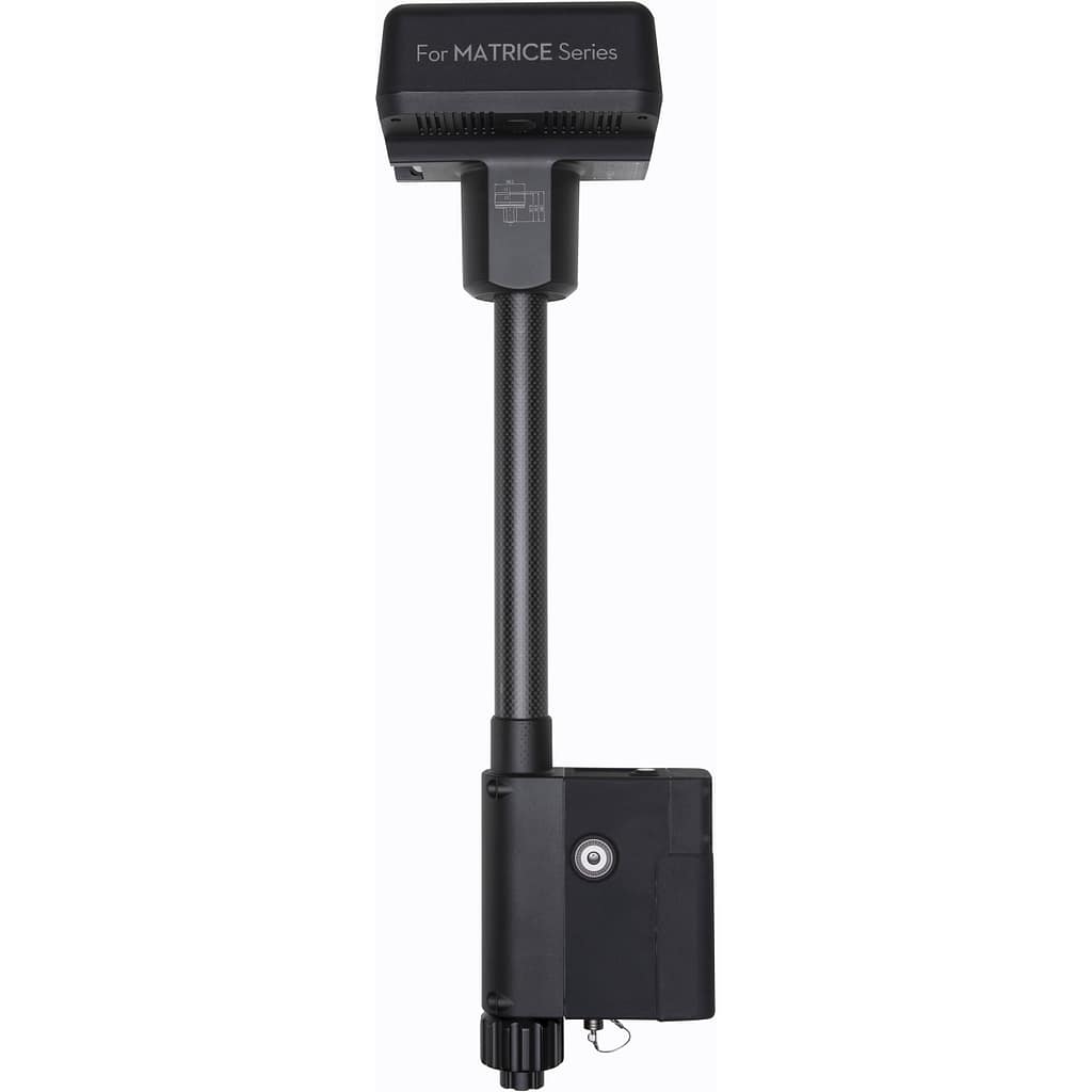
Equipment
DJI Mavic 3 Enterprise
(GNSS) DJI-RTK2 Mobile Base Station
Equipment
in just 3 s
1
Simple, clean & minimal Full Site Editing theme.
3
Select the color of your choice from the variations available.
CEO & Remote Pilot in Command
Straightforward
Pricing Plans
We offer a range of plans to suit businesses of all sizes, from small startups to large corporations.
Call to Action
Add Your Heading Here
Lorem ipsum dolor sit amet, consectetur adipisicing elit, sed do eiusmod tempor incididunt ut labore et dolore magna aliqua. Duis aute irure dolor in reprehenderit in voluptate velit esse cillum dolore eu fugiat nulla pariatur.
Excepteur sint occaecat cupidatat non proident, sunt in culpa qui officia deserunt mollit anim id est laborum.
Stay Updated
Latest Articles
Quickly browse the latest offers, read in-depth articles, and case studies to get the full story.


Ready to revolutionize the way you manage your projects?
Contact us today to learn how Nasha.AI can help you stay ahead with the power of Digital Twin technology and drone-based 3D modeling.